
The Blackfoot Valley's News Source Since 1980
The Blackfoot Valley's News Source Since 1980
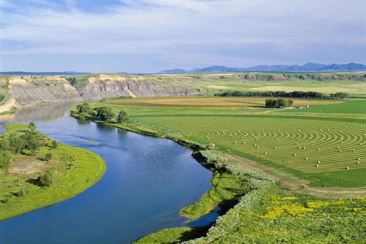
The Missouri River meanders through Montana farmland above Fort Benton.

When the Missouri River puts Cascade behind, it looks out toward the sunset and the distant Rocky Mountain Front, the range of mountains that gave Montana its label "Land of the Shining Mountains."
On July 18, Lewis wrote, "We passed the entrance a beautifull river 80 yards wide which falls in a Lard (left side). Which in honour of Mr. Roberts Smith secretary of the navy we called Smiths River. This stream meanders through a most lovely valey to the S.E. for about 25 miles when it enters the Rocky mountains and is concealed from our view."
The Smith River, one of Montana's favorites for fly-fishing and floating, works its way out of the Little Belt Mountains, then forges west to the Missouri near the hamlet of Ulm. Closing in on the city of Great Falls, a succession of forthcoming dams causes the Missouri to slow and relinquish its freedom. No longer looking like a big river, it now takes on an appearance of a lake – one of the large inlets is even called Broadwater Bay.
This segment of the river was highly significant in the annals of Lewis and Clark. During their 1804-05 winter encampment at Fort Mandan, near present-day Bismarck, North Dakota, the Corps learned from the Hidatsa Indians that one of the principal landmarks along the water route to the Rocky Mountains was a "great falls."
On the south side of Great Falls, the White Bear Islands, so labeled by Capt. Clark owing to the many grizzlies inhabiting them, come up first. They served as the base for the Upper Portage Camp during the very difficult traverse around the falls. When Lewis and Clark came through this country, these giant creatures were yet prairie animals. The islands not only served a feast of washed up buffalo carcasses for the bears, but the sand was soft, enabling them to easily excavate winter dens alongside the cottonwood trees.
The site of the Upper Portage Camp is still visible today, although time has silted in the channel that existed between it and the island they used for storage. The former riverbed is a very obvious depression running through a hay field. A lone cottonwood stands on the edge of what was once the riverbank.
Downriver from the islands on the west edge of Great Falls, the Sun River (another Hidatsa landmark) enters the now lake-like Missouri. Lewis's entry for June 14, 1805, included, "I determined to procede ... convinced that it was the river the Indians call 'medicine' (Sun)."
Five barriers – Black Eagle, Rainbow, Cochran, Ryan and Morony dams, all within 12 miles of each other, have obliterated the wondrous beauty Lewis described on June 13, 1805. After questioning whether or not the Corps had made the right decision concerning the Marias River not being the Missouri and that they were following the correct waterway, Lewis was desperately searching for the falls the Hidatsa had foretold of. "... whin my ears were saluted with the agreeable sound of a fall of water and advancing a little further I saw the spray arrise above the plain like a collumn of smoke ... which soon began to make a roaring too tremendous to be mistaken for any cause short of the great falls of the Missouri." Lewis clambered down a steep cliff in order "to gaze on this is sublimely grand specticle ... the grandest sight I ever beheld."
Struck by a feeling of complete inadequacy to put into words the power and splendor of the sight before him, Lewis wished for the talent of an artist "that I might be enabled to give to the enlightened world some just idea of this truly magnificent and sublimely grand object ... to give the world some faint idea of an object which at this moment fills me with such pleasure and astonishment, and which of it's kind I will venture to ascert is second to but one in the known world." Being so overwhelmed, he set camp on the bank below the falls, since greatly diminished by Ryan Dam.
The next day, Lewis headed off alone to scout the river above the falls. A quick five miles brought him to an unexpected second water cascade he named Crooked Falls. Then being led by "a tremendous roaring above me," Lewis was assaulted by the scene of another "great cataract" that "rivals for glory" the one "which I had discovered yesterday." This once glorious Rainbow Falls has been robbed of much of her splendor by the construction of Rainbow Dam. Almost immediately, Lewis stumbled onto another waterfall (no longer visible); becoming jaded he explained, "in any other neighborhood but this, such a cascade would probably be extolled for it's beauty and magnifficence, but here I passed it by with but little attention ... At a distance of 21⁄2 miles I arrived at another cataract of 26 feet ... below this falls at a little distance a beautiful little Island ... is situated about the middle of the river. In this Island on a Cottonwood tree an Eagle has placed her nest." Another landmark complete with the noble bird's abode, just as the Hidatsa had described it!
The present-day name came more than 70 years later when Thomas P. Roberts, a railway engineer doing survey work, was nearly attacked by a black eagle while viewing the falls. Upon noticing the bird's nest in a cottonwood tree on an island below the thundering curtain of water, he recalled Lewis's mention of the same, and thought it fitting to christen the site Black Eagle Falls.
Somehow, something had been lost in the translation at Fort Mandan that past winter. Initially, from the information given by the Hidatsa, the captains assumed there would be just one falls and that it would only take a half-day to get around it. With a total of five major falls each separated by rapids, obviously the portage was going to take much longer.


Reader Comments(0)