
The Blackfoot Valley's News Source Since 1980
The Blackfoot Valley's News Source Since 1980
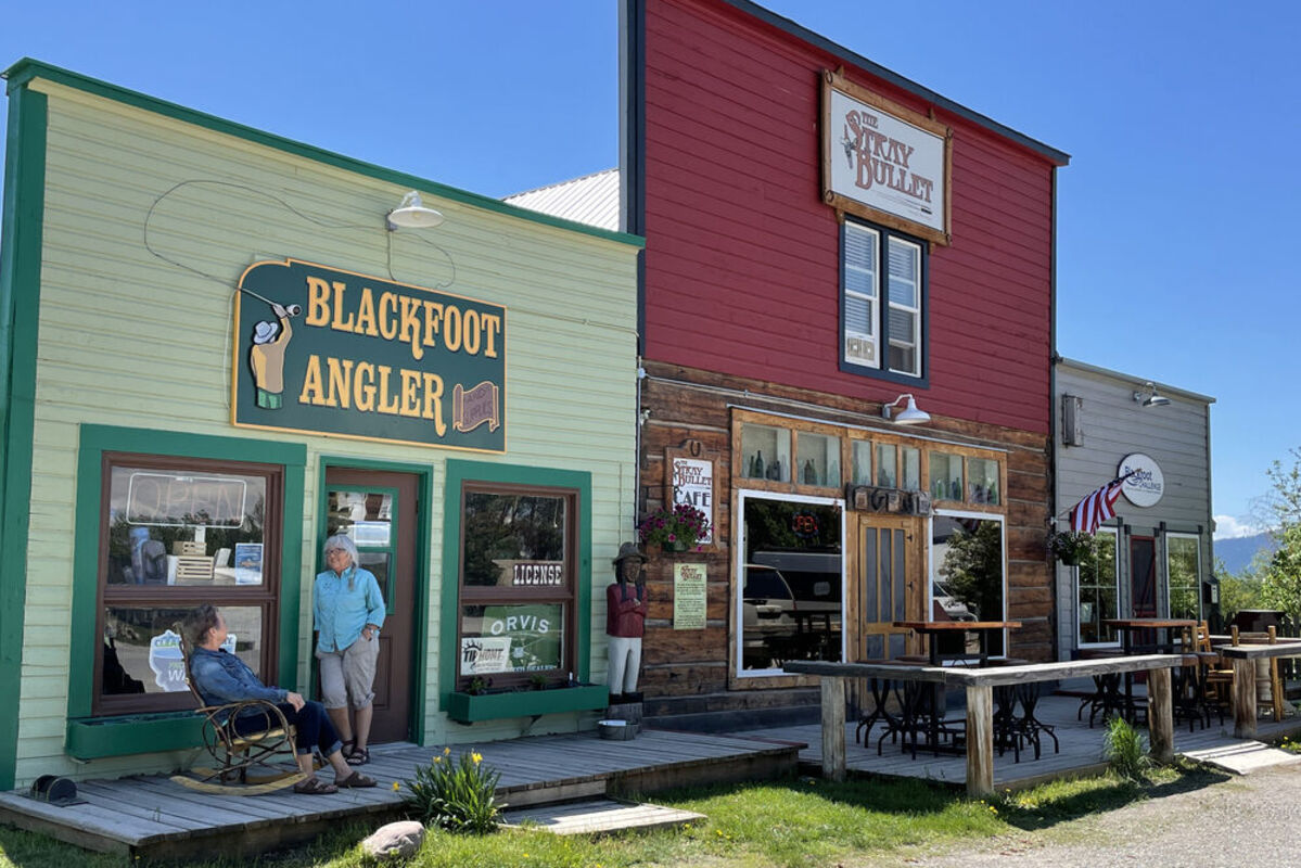
Downtown Ovando
Long on scenery and short on population the middle Blackfoot River Valley is the epitome of rural Montana. Mountains of the fabled Bob Marshall Country form its northern horizon and forested uplifts of the Garnet Range guard the southern perimeter. And a river runs through it.
Since Montana earliest years when homesteaders made their way here, the valley has remained a ranching domain. And like many old Montana towns, Ovando, its human enclave has weathered countless storms and changes and has withstood the passage of time.
Glaciation of the Pleistocene era is responsible for the unique topography of the region. Large glaciers, born in the high country to the north spilled to the valley and spread outward forming a large apron of ice or in geo speak, a piedmont glacier. This segment of the Blackfoot Valley also served as a glacial outwash plain. In the summers melting ice carrying rocks and soils from the higher terrain became muddy silt laden water randomly spreading anywhere a channel could be found. The valley was a mess of ice and mud!
As the glaciers slowly receded with a warming climate, deposits of rock and mud were left behind creating the elongated moraines seen today. In other parts of the valley finer materials filtered through crevasses in the glacier and created, as Meriwether Lewis penned in his journal, "knobs". These are the almost conical shaped features properly called kames. They give the valley a hummocky look. In several places small shallow ponds or wetlands sit in between these formations.
Long before the Corps of Discovery passed by what is now Ovando, many of Montana's original people including the Kootenai, Salish, Nez Perce, Blackfeet, and Pen d' Oreilles used the Blackfoot corridor to travel to the prairie lands to the east to hunt bison. They called it Cokalahishkit, "The River of the Road to the Buffalo."
Ovando Hoyt, the town's namesake landed in the valley in the 1882. As the new settlement grew, a post office became a necessity. Hoyt wrote to the federal government to petition for a post office and to become an official town. He originally suggested the place be called "Sadieville," though who or what Sadie had been lost to time. Postal officials thought "Ovando" was a more interesting name. Hoyt became the first postmaster serving in that role from 1883 to 1898.
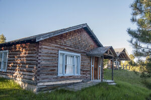
For the next few decades, Ovando grew. In 1884 a schoolhouse was built, and is still open today, enrolling 35 students every year. Later, Charles Jakways built a telephone line from Ovando to Drummond, founding the Blackfoot Telephone Company in the process. At the beginning of the 20th century, the town had a bustling commercial district including US Forest Service Headquarters, and was expecting the Blackfoot Railroad to be built to the town. Unfortunately, a massive fire in 1919 destroyed much of the commercial district, and the railroad was never completed. But these hardships did not stop the town from continuing to prosper. And today it can brag of several 100-year-old buildings still standing, including Ovando Hoyt's original house.
By 1920 the population swelled to about 100 people; the 2020 census showed 83 people live in town and the surrounding area.
Placed in the splendid beauty of the Blackfoot River Valley, the landscape surrounding Ovando draws many visitors as the community boasts that they have more scenery per capita than any other small town.
Nearby the Blackfoot River is one of Montana's great fisheries. Even in the heat of the summer, there are deep pools and swirling waters to cast for Rainbow Trout, Brook Trout, and more. Whether floating or wading, or finding a spot along the river, this area is a paradise for fishing. It makes sense that Normal Maclean based his famous book, A River Runs Through It on the Blackfoot.
And while fly fishing has helped develop a sustainable economy, In the past five years, bicycling has become another seasonal mainstay of the community's well-being. Ovando is on the Great Divide Trail, a route that follows as close as possible the Continental Divide from Banff, Alberta to Antelope Wells, New Mexico. Last year approximately 3,000 cyclists either camped or stopped in town. The people of this attractive place, with a "downtown square" developed around a triangle are part of the reason. Howie Fly, Ovando's historian, said last year the place was named "Montana's friendliest town".
While most visitors camp, the Blackfoot Commercial Company and Ovando Inn – the general store and the hotel are one business – offers lodging and two dining places Trixi's Antler Saloon and the Stray Bullet Café (the name comes with a great story, but you'll need to go ask them yourself) offer true local experiences.
For those interested in history and memorabilia, the Brand Bar Museum is filled with an impressive collection of stories from the first settlers, maps, and many memories of Ovando's antiquity. In 1897 and beyond the building was a saloon named the "Bucket of Blood". Over time it changed hands several times but was operated as a watering hole for local cowboys. In the late 1950s Trixi McCormick took over the building and it served as the original Trixi's until she moved it the saloon and café to its current location.
Trixi's real name was Ethel Stokes, formerly a rodeo roper and trick rider. Supposedly she paid $1 for the new building once an army barracks from Fort Harrison near Helena.
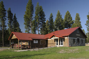
Headquarters for the highly respected Blackfoot Challenge is another prominent structure on the "town square". A research project of native northern prairie grasses showed that the Blackfoot Valley was one of only five in the Northern Rockies where any substantial sections of untouched prairie grasslands remained. The Challenge, a nonprofit organization of local private landowners has taken the lead in protecting this natural asset and keeping the Blackfoot's large landscapes and rural lifestyle intact. It is organized locally but known nationally as a model for preserving the rural character and natural beauty of a watershed.
With "dark skies" becoming a tourism draw, this Blackfoot Valley location fits in well. With exception of the few lights of the town center, just across Highway 200 looking north the sky is a wide canopy of the unobstructed heavens. On a clear moonless night, especially in winter, the brilliance of the stars is unmatched. And when the solar winds are strong and the magnetic field over the northern reaches of the planet are vibrant, a celestial phenomenon, aurora borealis – the northern lights – dance on the horizon over the Swan Range and Bob Marshall Wilderness.
Access passages to "The Bob" and its southern reaches are easily reached from Ovando. Trails lead into the Danaher Meadows and points beyond. This colorful little town can be considered a base camp to some of America's most hallowed wild country.
Ovando is also hub for local family farms and ranches. Though spread out across the valley, the community is a tight knit group that comes together to celebrate throughout the year. One of the most popular events is the Mid-Winter-All-Ovando Luau, a February potluck where everyone braves the cold to see friends while wearing their brightest colors and best Hawaiian shirts. Every summer, Ovando folks again join to celebrate Independence Day with a parade and party that has been called "The Biggest Taste of Old Time Americana, by the Smallest Old Town." The community is proud of its history, landscape, and the fact that many of its residents are descendance of the earliest inhabitants. Their celebrations have the warmth and excitement of friendships that have lasted through all the changes Ovando has seen. And an welcoming atmosphere is evident.


Reader Comments(0)