
The Blackfoot Valley's News Source Since 1980
The Blackfoot Valley's News Source Since 1980
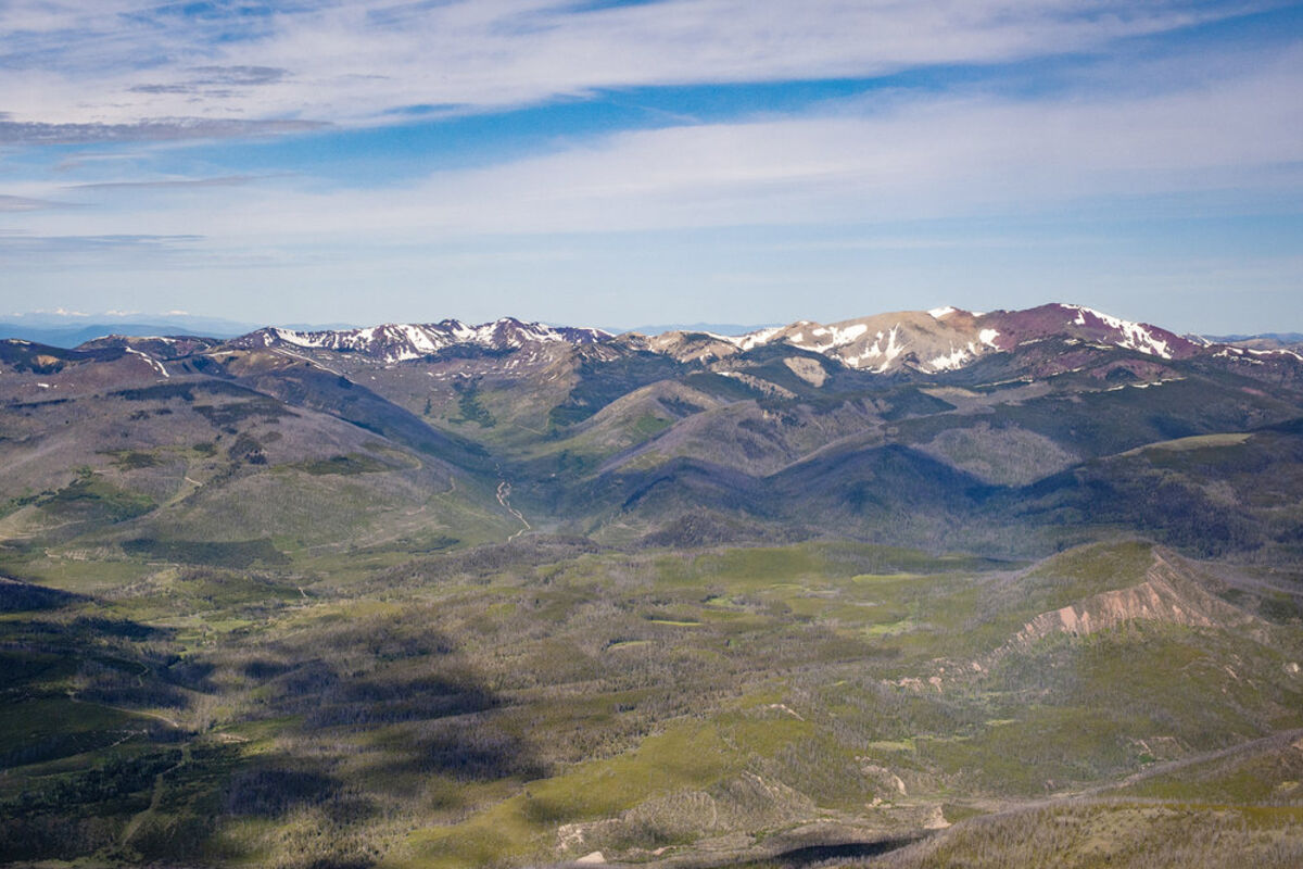
The view west from over Byrnes Creek shows Lone Mountain and a portion of the proposed eastern Scapegoat Wilderness addition in the foreground, with the proposed Stonewall Conservation Management Area in the distance on the far left, the proposed Copper Bowls Winter Recreation Area just to the left of center, and a second proposed addition to the Scapegoat Wilderness near Red Mountain to the right.
A flight over the Lincoln Valley and surrounding mountains provided a different perspective on the legislative proposal unveiled last month by the Upper Blackfoot Working Group.
Last Wednesday EcoFlight, a Colorado company that educates and advocates for the environment using small planes, took members of the group and guests on a tour of the proposal area, to get a different perspective on why th...

Reader Comments(0)